San Fernando de Valle de Catamarca - 900 kms
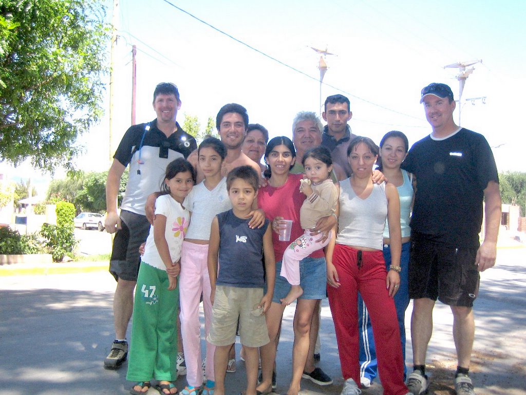
I'm reading Paul Thereau's Dark Star Safari while on this trip - it's been sitting on my night table for a year and I finally have time to read it (recounts this cranky traveler's trip through Africa). Although the setting is different its still fun to relate to anothe travelers complaints about heat, smelly people, diareha, beaurocracy, and great unexpected encounters with people like this group in the photo here. They are 3 generations of a poorer Porteño (residents of BA) family on a 2 week driving holiday all bunched into a ford pickup decked out with a homemade canopy complete with sleeping bunks and trailing a barbeque kitchen. They found us sitting below a tree during a break in our ride a few days ago. They were so hapy to tell us about their trip and what fun they were having. Asked about our bikes, and all the dodads such as cycle computors, altimeter, 2 way radios, etc. How do we stand the heat? Is there always snow in Canada?. Hugs and kisses from all of them as they leave and an invitation to have dinner with them when we return to BA.
------------------------------------------------------------------------------------------------
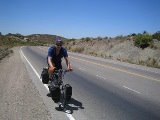
Never trust a map - at least not in this country. So many maps are wrong (German traveler's biggest gripe) but it is particulary annoying for a cyclist - especially when distances and understated - where the heck is that town as you ride further and further into the dusk. Well trusting as we are we followed a nice thick solid red road (indicating major highway) on the map a few days ago from Antiagasto crossing a mountain pass to Chumbicha in the La Rioja province. Rode 6 hours east to the start of the pass to find a Passar Prohibido - El Camino Cerrado sign. Oh what now, well we couldn't turn around this time in the day so over the dirt berm blocking the road and carry on up the closed highway. Up, into the wind, winding through switchbacks and low passing clouds, and cardon & prickly pear cactus covered hills we made it to the pass summit 2 hours later wondering if the road would continue through as it was steadilly deteriorating. We really didn't want to have to turn around and take another road to Catamarca which would add 130 more kms. As we continued the road turned to a goat path, clouds started turning to mist then rain, and dirt to mud - who made this map? no cars let alone any trucks could not have made it across this road in the past 20 years looking at the current condition. Finally came upon a closed gate that we squeezed by then steady improvement and all of the sudden 2 lane shouldered Superhighyway covered in cow poop. Well it was another stinky 20 kms of downhill in the rain with wet cow poop sraying me in the face off my tire until we made it to the bottom of the pass. Set up camp in the bush, brushed my teeth, and swore I would get better fenders inthe next town!
posted by Eric Johansson at
5:14 PM
![]()
![]()


0 Comments:
Post a Comment
Subscribe to Post Comments [Atom]
<< Home